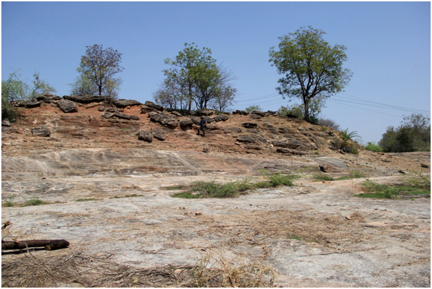
Nimar Sandstone Fm
Type Locality and Naming
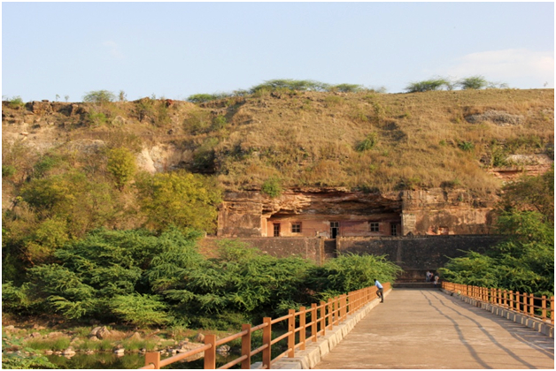
Type section is in Bagh Buddist (Panch Pandav) caves near Bagh town, Dhar district, Madhya Pradesh. Its thickness is about 20 m. [Original Publication: Blanford, W.T. (1869) Geology of the Taptee and lower Nerbudaa Valleys. Mem. Geol. Surv. India, v.6(3), pp.163-384; Bose, P.N. (1884) Geology of the Lower Narmada Valley between Nimavar and Kawant. Mem. Geol. Surv. India, v.21, pp.1-72]
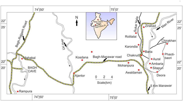
[Figure 1: Location map showing generalized Bagh outcrops (adapted from Ruidas et al, 2018)]
[Figure 2: Type section of Bagh Group in Bagh Caves near Bagh town, Dhar district, Madhya Pradesh]
Lithology and Thickness
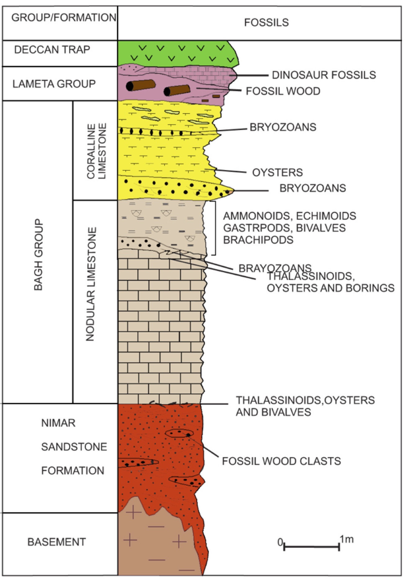
Sandstone. In the lower part, the Nimar Sandstone consists of thick-bedded, red ferruginous sandstone with occasional intercalations and siltstones of conglomerates. In its upper part, it is represented by coarse, medium and fine-grained sandstone with a few horizons of glauconitic sandstone and siltstone intercalations. Thickness varies from 35-40 m in the east to 100 m in the west.
[Figure 2b: Composite stratigraphic column of the Bagh Group (after Tripathi, 2006)]
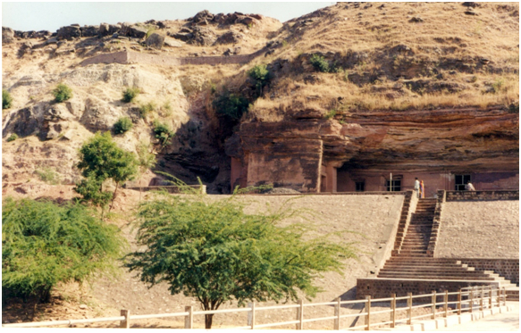
[Figure 3: Buddhist Caves of Bagh carved out of Nimar Sandstone. On the left side just below the wall, the white-colored sediments represent Nodular Limestone. At the top are the exposures of Coralline Limestone.]
[Figure 4: Nimar Sandstone outcrop near Rampura, near Bagh town]
Relationships and Distribution
Lower contact
Overlies the Precambrian basement rocks with a nonconformity.
Upper contact
Conformably overlain by the Nodular Limestone Fm, the contact between the two is sharp.
Regional extent
GeoJSON
Fossils
Oyster shells, shark remains, sauropod dinosaur remains (Khosla et al., 2003), trace fossils including Thalassinoides, calcareous algae (Kundal & Sanganwar (1998), palynological assemblage consisting of Late Jurassic – Early Cretaceous species (Kumar, 1994). Glossofungites ichnofacies with plenty of Thalassinoides burrows has also been documented from the heterolithic facies (Jha et al., 2016).
Age
Depositional setting
The lower part of Nimar Sandstone has been interpreted to have been deposited in a fluvial setting. The upper part of this formation was deposited under estuarine to shallow-marine depositional environment that ranged from sublittoral (Chiplonkar et al., 1977) to intertidal to subtidal (Singh & Srivastava, 1981) to transgressive storm and fairweather wave-dominated shelf (Bose & Das, 1986) or macrotidal estuarine complex (Ahmad & Akhtar, 1990), or upper subtidal to lower intertidal setting (Bhattacharya & Jha, 2014).
Additional Information
